
GEOGRAPHY OF INDIA
- Country Name: India/Bharat
- Other Names: Aryavarta, Jambudweep, Bharat Varsha, Hindustan
- Geographical Location: situated in North-Eastern Hemisphere
- Capital: New Delhi
- Latitudinal Extension: 8°4' to 37°6' Northern Latitude
- Longitudinal Extension: 68°7' to 97°25' Eastern Longitudes
- Standard Time: 82°30' Eastern Longitude (Mirzapur), 5 Hours 30 Minutes ahead of Greenwich mean time(London)
- Geographical Extension: North to South 3,214 km, East to West 2,933 km
- Land Boundary:26,106.7 km
- Water Boundary: 7,516.6 km
- Territorial water boundary: 12 nautical miles from the coast
- Exclusive Economic zone: 200 nautical miles from contiguous zone
- contiguous Zone: 24 nautical miles from coastal line
- Climate:Monsoon Climate
- Area:32,87,263 sq. km(2.42% world's total area)
- Position in terms of area: 7th
- Total Population: 1,210,193,422(17.5% pf world's total population)(census 2011)
- position in terms of Population:2nd
- Male Population:62,31,21,843(SIXTY TWO CRORE THIRTY ONE LAKH TWENTY ONE THOUSAND EIGHT HUNDRED AND FORTY THREE )
- Female Population:58,74,47,730(FIFTY EIGHT CRORE SEVENTY FOUR LAKH FORTY SEVEN THOUSAND SEVEN HUNDRED AND THIRTY )
- Rural Population:83.34 Crore (68.8%)
- Urban Population:37.71 Crore (31.2%)
- Decadal Growth:17.64% (2001-2011)
- Sex Ratio:943 per thousand males
- Population Density:382 Persons per sq km
- Literacy Rate:77.7%
- Male Literacy Rate:84.7%
- Female Literacy Rate:70.3%
- Scheduled Caste Population:20,13,78,086(16.6% of total Population)
- Scheduled Tribes Population:10,42,81,034(8.6% of total Population)
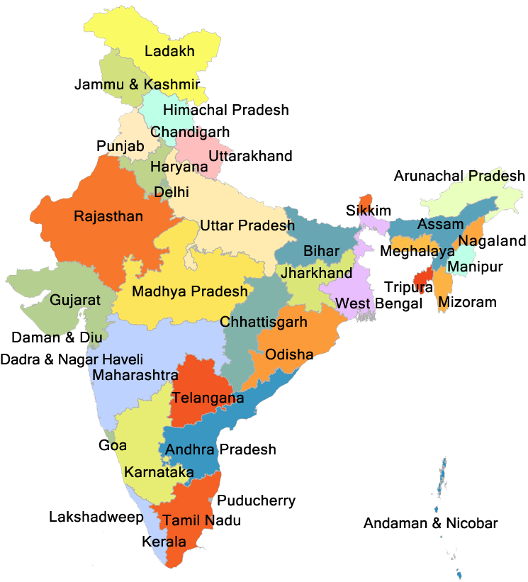
- Number of States:28
- Union Territories:8
- Geometrical Shape:Quadrangular
- Extension of Mountainous Region:10.7%
- Extension of Hill Area:18.6%
- Extension of Plateau Region:27.7%
- Extension of Fields:43%
- Tropic of cancer passes through:8 states: Gujarat (Jasdan), Rajasthan (Kalinjarh), Madhya Pradesh (Shajapur), Chhattisgarh (Sonhat), Jharkhand (Lohardaga), West Bengal (Krishnanagar), Tripura (Udaipur) and Mizoram (Champhai).
- States/UTs sharing International Boundaries:18
- Northern most point: Indira Col 36°6'
- Western most point: Guhar Moti Gujarat 68°7'
- Southern most point of India's mainland: Kanyakumari (Cape Comorin) 8°4'
- Eastern most point: Kibithu 97°25'
note:Tropic of Cancer is an imaginary line, at an angle of 23.50 degrees North from the Equator, that passes through the middle of India. If you run this imaginary line around Earth (Yes, Flat-Earthlings, the Earth is spherical), it passes through 17 countries, India being one of them.
During Summer Solstice, that is, June 21, sun falls perpendicularly on the Tropic of Cancer. Right Angle means it's the wrong time to wander outside. Because it is hot, earth is at it's hottest. And on December 21, the same thing happens on the southern hemisphere, on the Tropic of Capricorn. That's Winter Solstice for you.
Coastal States and Union Territories of India
| State | Coastline |
|---|---|
| 1,962.00 KM |
| 1,214.70 KM |
| 973.70 KM |
| 906.90.00 KM |
| 652.60 KM |
| 569.70 KM |
| 476.40 KM |
| 280.00 KM |
| 157.50 KM |
| 132.00 KM |
| 101.00 KM |
| 47.60 KM |
| 42.50 KM |
| 7,516.6 KM |
| 28 States of India | ||||
|---|---|---|---|---|
| States | Capital | Official Language | Number of District | Area (sq. KM) |
| Rajasthan | Jaipur | Hindi | 33 | 3,42,239 | >
| Madhya Pradesh | Bhopal | Hindi | 52 | 3,08,255 |
| Maharashtra | Mumbai | Marathi | 36 | 3,07,713 |
| Uttar Pradesh | Lucknow | Hindi, Urdu | 75 | 2,40,928 |
| Gujarat | Gandhinagar | Gujarati | 33 | 1,96,024 |
| Karnataka | Bengaluru | Kannada | 31 | 1,91,791 |
| Andhra Pradesh | Amaravati | Telugu | 26 | 1,60,205 |
| Odisha | Bhubaneswar | Oriya(Odia) | 30 | 1,55,707 |
| Chattisgarh(Founded: 1 November 2000) | Raipur(Atal Nagar) | Hindi | 32 | 1,35,191 |
| Tamil Nadu | Chennai | Tamil | 38 | 1,30,058 |
| Telangana(Founded: 2 June 2014) | Hyderabad | Urdu, Telugu | 33 | 1,14,880 |
| Bihar | Patna | Hindi | 38 | 94,163 |
| West Bengal | Kolkata | Bangla | 23 | 88,752 |
| Arunachal Pradesh | Itanagar | English | 25 | 83,743 |
| Jharkhand(15 November 2000) | Ranchi | Hindi | 24 | 79,714 |
| Assam | Dispur | Assamese | 34 | 78,438 |
| Himanchal Pradesh | Shimla/Dharmshala | Hindi | 12 | 55,673 |
| Uttarakhand(Formation: 9 November 2000) | Dehradun/Gairsain | Hindi, Sanskrit | 13 | 55,483 |
| Punjab | Chandigarh | Punjabi | 23 | 50,362 |
| Haryana | Chandigarh | Hindi | 22 | 44,212 |
| Kerala | Thiruvananthapuram(तिरुवनंतपुरम) | Malayalam | 14 | 38,863 |
| Meghalaya | Shillong | Garo | 12 | 22,429 |
| Manipur | Imphal(इम्फाल) | Manipuri | 16 | 22,327 |
| Mizoram | Aizawl | Mizo | 8 | 21,081 |
| Nagaland | Kohima | English | 11 | 16,579 |
| Tripura | Agartala | Bangla | 8 | 10,491 |
| Sikkim | Gangtok | Nepali | 4 | 7,096 |
| Goa | Panaji | Konkani | 2 | 3,702 |
| 8 Union Territories India | |||
|---|---|---|---|
| Union Territories | Capital | Number of District | Area (sq. KM) |
| Andaman & Nicobar | Port Blair | 3 | 8,249 |
| Chandigarh | Chandigarh | 1 | 114 |
| Dadra & Nagar Haveli and Daman & Diu | Daman | 3 | 603 |
| Delhi | New Delhi | 11 | 1,483 |
| Lakshadweep | Kavaratti | 1 | 32 |
| Puducherry | Puducherry | 4 | 492 |
| Jammu & Kashmir | Srinagar/Jammu | 22 | 54,624 |
| Ladakh | Leh | 2 | 1,68,055 |
| Length of International Boundaries of India with Allied States | |||
|---|---|---|---|
| Country | Length(km) | Boundary Line Name | Indian States/UTs Along International Boundary |
| Bangladesh | 4,096.7 | Radcliffe Line | West Bengal, Meghalaya, Tripura, Mizoram,Assam |
| China | 3488 | McMahon and Johnson Line | Ladakh, Himanchal Pradesh, Uttarakhand, Sikkim, Arunachal Pradesh |
| Pakistan | 3,323 | Radcliffe Line | Gujarat, Rajasthan, Punjab, Jammu and Kashmir, Ladakh |
| Nepal | 1,751 | - | Uttarakhand, Uttar Pradesh, Bihar, West Bengal, Sikkim |
| Myanmar | 1,624 | - | Arunachal Pradesh, Nagaland, Mizoram, Manipur |
| Bhutan | 699 | - | west Bengal, Sikkim, Assam, Arunachal Pradesh |
| Afganistan | 106 | Durand Line | Ladakh(PoK) |